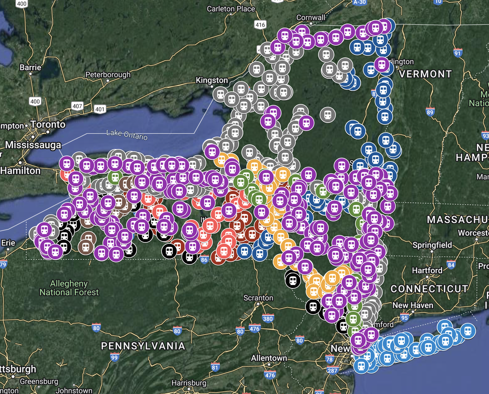
Existing Railroad Stations in New York State
In the early 1990s, I had been compiling a database of existing classic railroad stations in New York. After gathering about 200 stations, I decided to construct a web site, which I launched in 1996. Within a year, through collaboration with many others, the count skyrocketed to nearly 1,000. Today, the collection hovers around 850, due to a great number of stations being razed in the last quarter century. While researching these stations has been personally rewarding, I feel that sharing this information on the Internet helps others who are interested in the history and preservation of classic railroad stations.
This site was the first of its type (cataloging existing classic railroad stations within a single state) on the Internet. Subsequent states followed, including PA, NH, and OH.
From Summer 2020 through Autumn 2023, the content of these pages went through a significant overhaul, which was the result of thousands of miles of driving and hundreds of hours visiting these ever-disappearing stations to re-photograph them. In the process, I confirmed the demise of many stations, and discovered a few new ones. I also decided to carefully record and publish the precise GPS coordinates for each station, because addresses — which I used in older versions of the site — were not able to convey their location adequately. These three-plus years of work gave me a view of the entirety of New York State that I don't think any other form of travel could have provided. I hope that you, too, can explore the depth and breadth of New York State through the eyes of the stations left from the railroads that helped form the communities that exist today.
If you have photos, send them in: email me. A small credit line at the bottom is helpful, although I can add it. The photos of the old site were small to save space back in 1996. Now I'm standardizing on something around 1600 pixels wide.
A tip - if you are looking at a station in a county page, click the photo. You'll see a large version along with a history of the photos for that station below the photo. That gives you a chance to see how the station has changed over time.
See the FAQ for what the column headings mean.
—Charles Woolever
Recent Updates
- March 28, 2024 - Removed the NKP Angola station from Erie County. It was torn down last Fall.
- November 5, 2023 - Added a section below called “Interactive Map.”
- October 28, 2023 - Finished updating Dutchess NYC Dover Plains freight house.
- October 28, 2023 - Finished updating Putnam, Westchester, and Rockland Erie Railroad New City with new photos and data.
- September 17, 2023 - Finished Dutchess County with updated data and photos. CNE Verbank freight house was moved to 21 Freedom Rd, Pleasant Valley, NY. Unable to locate there. Taken down board by board but not sure of current status. The CNE Red Hook passenger depot is gone, torn down to build a new business (was a house). Still need an updated photo of the Dover Plains freight house.
- September 17, 2023 - Finished Ulster County with updated data and photos. Everything is still standing!
- August 20, 2023 - Updated the RL&B Gasport station in Niagara County with a photo.
Counties
This is the beating heart of this web site, where all pertinent station information is available.
- Albany
- Allegany
- Bronx
- Broome
- Cattaraugus
- Cayuga
- Chautauqua
- Chemung
- Chenango
- Clinton
- Columbia
- Cortland
- Delaware
- Dutchess
- Erie
- Essex
- Franklin
- Fulton
- Genesee
- Greene
- Hamilton
- Herkimer
- Jefferson
- Kings
- Lewis
- Livingston
- Madison
- Monroe
- Montgomery
- Nassau
- New York
- Niagara
- Oneida
- Onondaga
- Ontario
- Orange
- Orleans
- Oswego
- Otsego
- Putnam
- Queens
- Rensselaer
- Richmond
- Rockland
- St Lawrence
- Saratoga
- Schenectady
- Schoharie
- Schuyler
- Seneca
- Steuben
- Suffolk
- Sullivan
- Tioga
- Tompkins
- Ulster
- Warren
- Washington
- Wayne
- Westchester
- Wyoming
- Yates
Interactive Map
The image below is linked to an interactive Google map that allows you to toggle any one of ten railroad layers on or off. It is not an alternative to the “Counties” tables above; it is merely a simple visualization tool of the locations of all known existing stations. There is a limitation in Google Maps that allows me to have only 10 layers on the map; nine of the largest railroads are viewable on their own layer, and all other railroads are aggregated in a layer called “OTHER.” It’s important to note that each station’s current location is not necessarily its original location as indicated in the “Counties” tables on this website. The “Counties” tables also offer far more information about each station than is possible in the Interactive Map.
Links
Links to other NY station sites and a few in the rest of the U.S.
Verify
Please check here to help locate missing stations.
FAQ
Frequently Asked Questions.
